
Thank you for supporting this site ❤️
Make a donation
Make a donation
Kampung Perak topographic map
Click on the map to display elevation.
Thank you for supporting this site ❤️
Make a donation
Make a donation
About this map
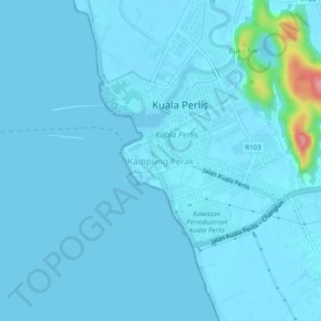
Name: Kampung Perak topographic map, elevation, terrain.
Location: Kampung Perak, Perlis, 02000, Malaysia (6.37633 100.11212 6.41633 100.15212)
Average elevation: 6 m
Minimum elevation: -2 m
Maximum elevation: 114 m
Thank you for supporting this site ❤️
Make a donation
Make a donation
Other topographic maps
Click on a map to view its topography, its elevation and its terrain.