
Thank you for supporting this site ❤️
Make a donation
Make a donation
Dufton Pike topographic map
Click on the map to display elevation.
Thank you for supporting this site ❤️
Make a donation
Make a donation
Dufton Pike
Dufton Pike is a hill in the northern Pennines, in Cumbria, England. It is classed as a Marilyn (a hill with topographic prominence of at least 150m). It rises above the village of Dufton.
Thank you for supporting this site ❤️
Make a donation
Make a donation
About this map
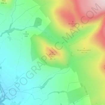
Name: Dufton Pike topographic map, elevation, terrain.
Average elevation: 313 m
Minimum elevation: 154 m
Maximum elevation: 604 m
Thank you for supporting this site ❤️
Make a donation
Make a donation
Other topographic maps
Click on a map to view its topography, its elevation and its terrain.