
Sóller topographic map
Interactive map
Click on the map to display elevation.
About this map
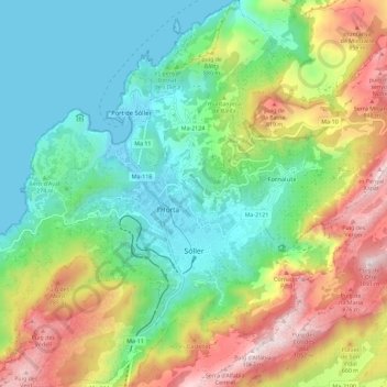
Name: Sóller topographic map, elevation, terrain.
Location: Sóller, Serra de Tramuntana, Balearische Inseln, Spanien (39.73358 2.66206 39.82337 2.76020)
Average elevation: 376 m
Minimum elevation: -1 m
Maximum elevation: 1,070 m
Other topographic maps
Click on a map to view its topography, its elevation and its terrain.
Puigpunyent
Spanien > Balearische Inseln > Serra de Tramuntana
Puigpunyent, Serra de Tramuntana, Balearische Inseln, Spanien
Average elevation: 392 m