
Saivelette topographic map
Interactive map
Click on the map to display elevation.
About this map
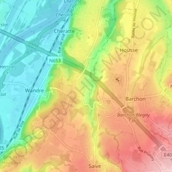
Name: Saivelette topographic map, elevation, terrain.
Location: Saivelette, Blegny, Liège, Wallonie, 4670, Belgique (50.65121 5.65877 50.69121 5.69877)
Average elevation: 138 m
Minimum elevation: 53 m
Maximum elevation: 237 m
Other topographic maps
Click on a map to view its topography, its elevation and its terrain.
Les Aunois
Belgique > Liège > Liège > Blegny
Les Aunois, Blegny, Liège, Wallonie, 4670, Belgique
Average elevation: 185 m