
Nichols Hills topographic map
Interactive map
Click on the map to display elevation.
About this map
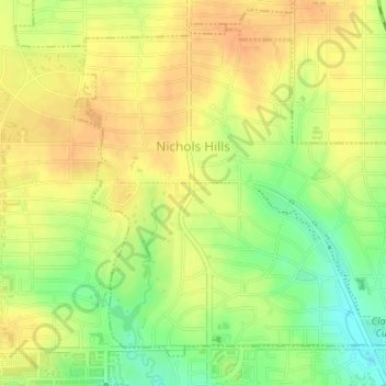
Name: Nichols Hills topographic map, elevation, terrain.
Location: Nichols Hills, Oklahoma County, Oklahoma, United States (35.53620 -97.55926 35.55907 -97.52849)
Average elevation: 369 m
Minimum elevation: 347 m
Maximum elevation: 381 m