
Make a donation
Argentera topographic map
Click on the map to display elevation.
Make a donation
Argentera
Argentera borders the following municipalities: Acceglio, Canosio, Larche (France), Pietraporzio, and Saint-Etienne-de-Tinée (France). Its territory includes peaks such as the Oserot at an elevation of 2,860 metres (9,380 ft) above sea level, Enciastraia at 2,955 metres (9,695 ft) and the Rocca dei Tre Vescovi at 2,867 metres (9,406 ft).
Make a donation
About this map
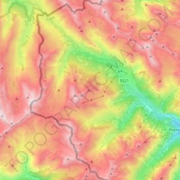
Name: Argentera topographic map, elevation, terrain.
Location: Argentera, Cuneo, Piedmont, Italy (44.31929 6.88701 44.42996 7.03051)
Average elevation: 2,195 m
Minimum elevation: 1,245 m
Maximum elevation: 2,935 m
Make a donation
Other topographic maps
Click on a map to view its topography, its elevation and its terrain.
Make a donation
Croce di Envie - Cima Bracco
Italy > Piedmont > Cuneo > Sanfront
The Monte Bracco (though the name is sometimes shortened to Mombracco) is a mountain in the Cottian Alps with an elevation of 1,307 meters above sea level. It is located between the Valle Po, the Valle Infernotto [it], and the Cuneo plain.
Average elevation: 947 m
Make a donation
Make a donation
Make a donation
Monviso
Italy > Piedmont > Cuneo > Pontechianale
Monte Viso is the location of a Neolithic jadeite quarry, at an elevation of 2,000 to 2,400 metres. Its productivity peaked around 5000 BC. The jadeite was used to make cult axes, which are found all over western Europe. One such ceremonial axe head was found as far away as a small hill called Tristia in…
Average elevation: 2,985 m
Make a donation
Make a donation
Make a donation
Make a donation
Monviso
Italy > Piedmont > Cuneo > Pontechianale
Monte Viso is the location of a neolithic jadeite quarry, at an elevation of 2,000 to 2,400 metres. Its productivity peaked around 5000 BC. The jadeite was used to make cult axes, which are found all over western Europe. One such ceremonial axe head was found as far away as a small hill called Tristia in…
Average elevation: 2,985 m
Make a donation
Make a donation
Giardino Famiglia Allemandi
Italy > Piedmont > Cuneo > Villar San Costanzo > Pramallé
Average elevation: 654 m
Monviso
Italy > Piedmont > Cuneo > Pontechianale
Monte Viso is the location of a neolithic jadeite quarry, at an elevation of 2000 to 2400 metres. Its productivity peaked around 5000 BC. The jadeite was used to make cult axes, which are found all over western Europe. One such ceremonial axe head was found as far away as a small hill called Tristia in Western…
Average elevation: 2,985 m
Make a donation