
Thank you for supporting this site ❤️
Make a donation
Make a donation
Khon Kaen topographic map
Click on the map to display elevation.
Thank you for supporting this site ❤️
Make a donation
Make a donation
Khon Kaen
Khon Kaen is on the Khorat Plateau, elevation 187 m, and is the center of the mid-northeastern provincial group of Thailand, according to the Thai government. Its coordinates are 16°26′N 102°50′E / 16.433°N 102.833°E / 16.433; 102.833. The city has a population of 114,459.
Thank you for supporting this site ❤️
Make a donation
Make a donation
About this map
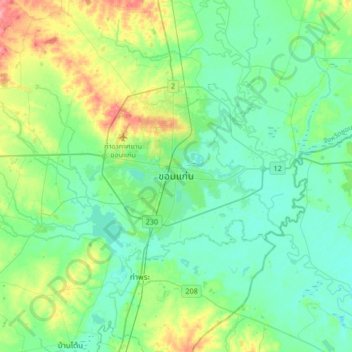
Name: Khon Kaen topographic map, elevation, terrain.
Location: Khon Kaen, Mueang Kao, Khon Kaen Province, 40000, Thailand (16.27039 102.67559 16.59039 102.99559)
Average elevation: 165 m
Minimum elevation: 144 m
Maximum elevation: 230 m
Thank you for supporting this site ❤️
Make a donation
Make a donation