
Cannara topographic map
Interactive map
Click on the map to display elevation.
About this map
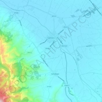
Name: Cannara topographic map, elevation, terrain.
Location: Cannara, PG, Umbria, 06033, Italy (42.94641 12.49285 43.02139 12.60635)
Average elevation: 235 m
Minimum elevation: 182 m
Maximum elevation: 695 m