
Güferhorn topographic map
Interactive map
Click on the map to display elevation.
About this map
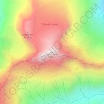
Name: Güferhorn topographic map, elevation, terrain.
Location: Güferhorn, Rheinwald, Viamala, Grigioni, Svizzera (46.51237 9.06298 46.51247 9.06308)
Average elevation: 2,809 m
Minimum elevation: 2,224 m
Maximum elevation: 3,338 m
Other topographic maps
Click on a map to view its topography, its elevation and its terrain.