
Purandar topographic map
Interactive map
Click on the map to display elevation.
About this map
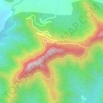
Name: Purandar topographic map, elevation, terrain.
Location: Purandar, Purandhar, Maharashtra, 412302, India (18.28003 73.97425 18.28013 73.97435)
Average elevation: 1,044 m
Minimum elevation: 815 m
Maximum elevation: 1,370 m
Other topographic maps
Click on a map to view its topography, its elevation and its terrain.
Saswad
India > Maharashtra > Purandhar
Saswad, Purandhar, Pune, Maharashtra, 412300, India
Average elevation: 787 m