
Grant County topographic map
Interactive map
Click on the map to display elevation.
About this map
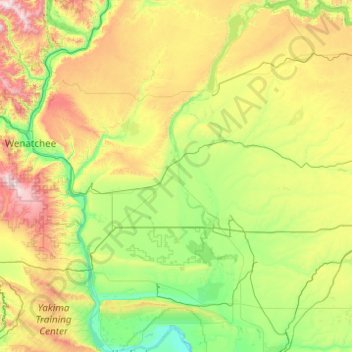
Name: Grant County topographic map, elevation, terrain.
Location: Grant County, Washington, États-Unis d'Amérique (46.62524 -120.04287 47.96215 -118.97350)
Average elevation: 563 m
Minimum elevation: 111 m
Maximum elevation: 2,111 m