
Sragi topographic map
Interactive map
Click on the map to display elevation.
About this map
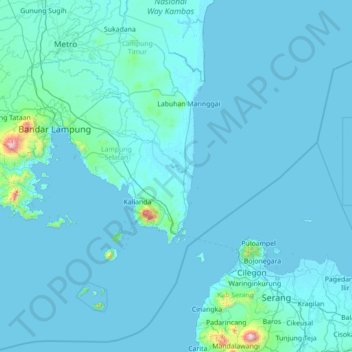
Name: Sragi topographic map, elevation, terrain.
Location: Sragi, Lampung, Indonesië (-6.33269 105.05006 -4.93269 106.45006)
Average elevation: 39 m
Minimum elevation: -2 m
Maximum elevation: 1,733 m