
Thank you for supporting this site ❤️
Make a donation
Make a donation
St-Jean VS topographic map
Click on the map to display elevation.
Thank you for supporting this site ❤️
Make a donation
Make a donation
About this map
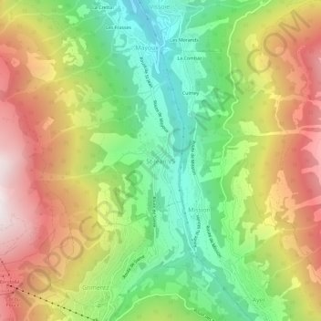
Name: St-Jean VS topographic map, elevation, terrain.
Location: St-Jean VS, Anniviers, Sierre, Wallis, 3961, Switzerland (46.17609 7.56557 46.21609 7.60557)
Average elevation: 1,669 m
Minimum elevation: 1,079 m
Maximum elevation: 2,381 m
Thank you for supporting this site ❤️
Make a donation
Make a donation
Other topographic maps
Click on a map to view its topography, its elevation and its terrain.