
Thank you for supporting this site ❤️
Make a donation
Make a donation
Erde topographic map
Click on the map to display elevation.
Thank you for supporting this site ❤️
Make a donation
Make a donation
About this map
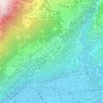
Name: Erde topographic map, elevation, terrain.
Location: Erde, Conthey, Valais, 1964, Suisse (46.21966 7.27163 46.25966 7.31163)
Average elevation: 858 m
Minimum elevation: 477 m
Maximum elevation: 2,145 m
Thank you for supporting this site ❤️
Make a donation
Make a donation
Other topographic maps
Click on a map to view its topography, its elevation and its terrain.