
Menderes topographic map
Interactive map
Click on the map to display elevation.
About this map
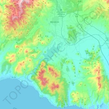
Name: Menderes topographic map, elevation, terrain.
Location: Menderes, Izmir, Ägäisregion, Türkei (37.98007 26.94379 38.31909 27.31370)
Average elevation: 198 m
Minimum elevation: -2 m
Maximum elevation: 1,005 m