Samothraki (Chora) topographic map
Interactive map
Click on the map to display elevation.
About this map
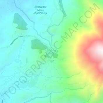
Name: Samothraki (Chora) topographic map, elevation, terrain.
Average elevation: 324 m
Minimum elevation: 13 m
Maximum elevation: 1,188 m

Click on the map to display elevation.
Name: Samothraki (Chora) topographic map, elevation, terrain.
Average elevation: 324 m
Minimum elevation: 13 m
Maximum elevation: 1,188 m