
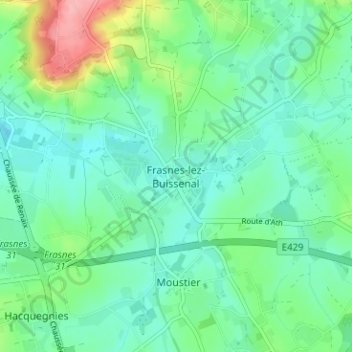
Frasnes-lez-Buissenal topographic map
Interactive map
Click on the map to display elevation.
About this map
Name: Frasnes-lez-Buissenal topographic map, elevation, terrain.
Location: Frasnes-lez-Buissenal, Ath, Hainaut, Wallonie, 7911, Belgique (50.64776 3.59945 50.68776 3.63945)
Average elevation: 51 m
Minimum elevation: 23 m
Maximum elevation: 133 m