
Thank you for supporting this site ❤️
Make a donation
Make a donation
Kloppenheim topographic map
Click on the map to display elevation.
Thank you for supporting this site ❤️
Make a donation
Make a donation
About this map
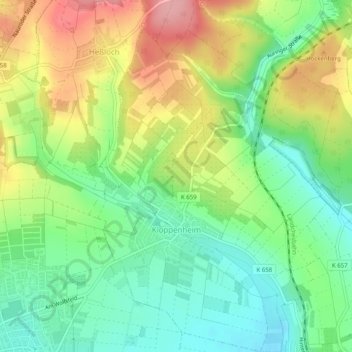
Name: Kloppenheim topographic map, elevation, terrain.
Location: Kloppenheim, Висбаден, Гессен, 65207, Германия (50.08331 8.29359 50.11537 8.33146)
Average elevation: 223 m
Minimum elevation: 171 m
Maximum elevation: 298 m
Thank you for supporting this site ❤️
Make a donation
Make a donation