
Thank you for supporting this site ❤️
Make a donation
Make a donation
Centrum topographic map
Click on the map to display elevation.
Thank you for supporting this site ❤️
Make a donation
Make a donation
About this map
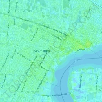
Name: Centrum topographic map, elevation, terrain.
Location: Centrum, Paramaribo, Suriname (5.80920 -55.18838 5.84001 -55.14451)
Average elevation: 4 m
Minimum elevation: -2 m
Maximum elevation: 9 m
Thank you for supporting this site ❤️
Make a donation
Make a donation
Other topographic maps
Click on a map to view its topography, its elevation and its terrain.