
Awantipora topographic map
Click on the map to display elevation.
About this map
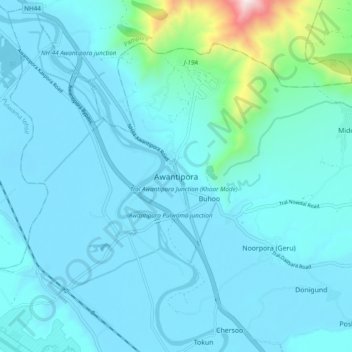
Name: Awantipora topographic map, elevation, terrain.
Location: Awantipora, Pulwama, Jammu and Kashmir, 192308, India (33.87891 74.97465 33.95891 75.05465)
Average elevation: 1,698 m
Minimum elevation: 1,583 m
Maximum elevation: 2,749 m
Other topographic maps
Click on a map to view its topography, its elevation and its terrain.