
Thank you for supporting this site ❤️
Make a donation
Make a donation
Pasirmunjul topographic map
Click on the map to display elevation.
Thank you for supporting this site ❤️
Make a donation
Make a donation
About this map
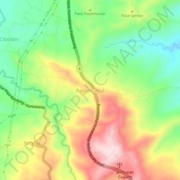
Name: Pasirmunjul topographic map, elevation, terrain.
Location: Pasirmunjul, Purwakarta, West Java, Java, Indonesia (-6.65929 107.40724 -6.61929 107.44724)
Average elevation: 318 m
Minimum elevation: 170 m
Maximum elevation: 501 m
Thank you for supporting this site ❤️
Make a donation
Make a donation
Other topographic maps
Click on a map to view its topography, its elevation and its terrain.