
Vinh topographic map
Interactive map
Click on the map to display elevation.
About this map
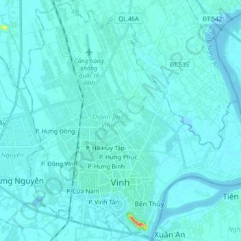
Name: Vinh topographic map, elevation, terrain.
Location: Vinh, Nghệ An Province, Vietnam (18.63932 105.63365 18.76521 105.76896)
Average elevation: 5 m
Minimum elevation: -1 m
Maximum elevation: 88 m
Other topographic maps
Click on a map to view its topography, its elevation and its terrain.
Cam Lâm
Vietnam > Nghe An province > Con Cuông District
Cam Lâm, Con Cuông District, Nghệ An Province, Vietnam
Average elevation: 101 m
Con Cuông District
Con Cuông District, Nghệ An Province, Vietnam
Average elevation: 430 m
X. Nghi Liên
Vietnam > Nghe An province > Vinh > X. Nghi Liên
X. Nghi Liên, Vinh, Nghe An province, Vietnam
Average elevation: 6 m