
Küsnacht (ZH) topographic map
Interactive map
Click on the map to display elevation.
About this map
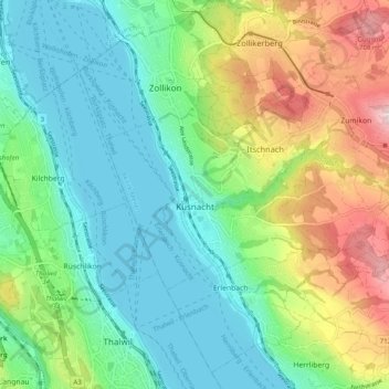
Name: Küsnacht (ZH) topographic map, elevation, terrain.
Location: Küsnacht (ZH), Bezirk Meilen, Zurich, 8700, Suisse (47.30331 8.56024 47.33586 8.65858)
Average elevation: 506 m
Minimum elevation: 400 m
Maximum elevation: 741 m
Other topographic maps
Click on a map to view its topography, its elevation and its terrain.
Lac de Zurich
Suisse > Zurich > Bezirk Meilen
Lac de Zurich, Bezirk Meilen, Zurich, Suisse
Average elevation: 553 m