
Бала-Саруу topographic map
Interactive map
Click on the map to display elevation.
About this map
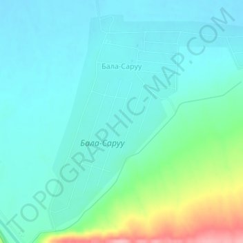
Name: Бала-Саруу topographic map, elevation, terrain.
Location: Бала-Саруу, Манасский район, Таласская область, Киргизия (42.67526 71.60110 42.69910 71.63546)
Average elevation: 823 m
Minimum elevation: 795 m
Maximum elevation: 928 m
Other topographic maps
Click on a map to view its topography, its elevation and its terrain.
Кара-Арча
Киргизия > Таласская область > Манасский район
Кара-Арча, Манасский район, Таласская область, Киргизия
Average elevation: 1,020 m