
Nissewaard topographic map
Interactive map
Click on the map to display elevation.
About this map
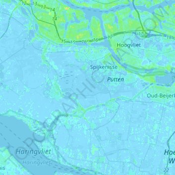
Name: Nissewaard topographic map, elevation, terrain.
Location: Nissewaard, Südholland, Niederlande (51.78277 4.18527 51.87299 4.43248)
Average elevation: 1 m
Minimum elevation: -6 m
Maximum elevation: 24 m
Other topographic maps
Click on a map to view its topography, its elevation and its terrain.
Hoeksche Waard
Niederlande > Südholland > Hoeksche Waard
Hoeksche Waard, Südholland, Niederlande
Average elevation: 0 m
Mijnsheerenland
Niederlande > Südholland > Hoeksche Waard
Mijnsheerenland, Hoeksche Waard, Südholland, Niederlande
Average elevation: 0 m
Bergschenhoek
Niederlande > Südholland > Lansingerland
Bergschenhoek, Lansingerland, Südholland, Niederlande
Average elevation: -3 m
Gorinchem
Niederlande > Südholland > Gorinchem
Gorinchem, Südholland, Niederlande
Average elevation: 1 m