
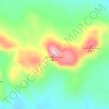
Flat Top Mountain topographic map
Interactive map
Click on the map to display elevation.
About this map
Name: Flat Top Mountain topographic map, elevation, terrain.
Location: Flat Top Mountain, Franklin County, New York, USA (44.52696 -74.54995 44.52706 -74.54985)
Average elevation: 568 m
Minimum elevation: 472 m
Maximum elevation: 729 m
Other topographic maps
Click on a map to view its topography, its elevation and its terrain.
Beachville
USA > New York > Beachville
Beachville, Steuben County, New York, USA
Average elevation: 555 m
Cumminsville
USA > New York > Cumminsville
Cumminsville, North Dansville Town, Livingston County, New York, 14437, USA
Average elevation: 238 m
Sawtooth Mountains
Sawtooth Mountains, Franklin County, New York, USA
Average elevation: 927 m
Jordan River
Jordan River, Saint Lawrence County, New York, USA
Average elevation: 479 m
Big Bear Mountain
Big Bear Mountain, Town of Johnsburg, Warren County, New York, USA
Average elevation: 616 m
Roosevelt Island
USA > New York > New York City
Roosevelt Island, Manhattan Community Board 8, New York County, New York City, New York, 10044, USA
Average elevation: 13 m
Lake Georgina
Lake Georgina, Lake Georgina Road, Woodbury, Town of Woodbury, Orange County, New York, 10930, USA
Average elevation: 290 m
Lake Cecil
Lake Cecil, Lake Cecil Road, Tacoma, Town of Masonville, Delaware County, New York, 13847, USA
Average elevation: 518 m
Mount Warren
Mount Warren, Town of Bovina, Delaware County, New York, USA
Average elevation: 677 m
Hen and Chicken Islands
Hen and Chicken Islands, Town of Long Lake, Hamilton County, New York, 13436, USA
Average elevation: 606 m