Cerdedo-Cotobade topographic map
Interactive map
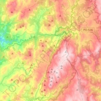
Click on the map to display elevation.
About this map
Name: Cerdedo-Cotobade topographic map, elevation, terrain.
Average elevation: 573 m
Minimum elevation: 74 m
Maximum elevation: 1,014 m

Click on the map to display elevation.
Name: Cerdedo-Cotobade topographic map, elevation, terrain.
Average elevation: 573 m
Minimum elevation: 74 m
Maximum elevation: 1,014 m