
Río Tocoa topographic map
Interactive map
Click on the map to display elevation.
About this map
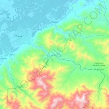
Name: Río Tocoa topographic map, elevation, terrain.
Location: Río Tocoa, Tocoa, Colón, Honduras (15.57971 -86.03014 15.66862 -85.82533)
Average elevation: 425 m
Minimum elevation: 17 m
Maximum elevation: 1,558 m
Other topographic maps
Click on a map to view its topography, its elevation and its terrain.