
Eldfell topographic map
Interactive map
Click on the map to display elevation.
About this map
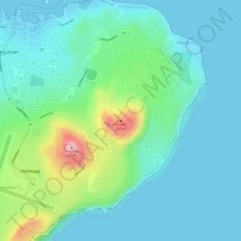
Name: Eldfell topographic map, elevation, terrain.
Location: Eldfell, Vestmannaeyjabær, Southern Region, 900, Iceland (63.43227 -20.24733 63.43237 -20.24723)
Average elevation: 45 m
Minimum elevation: -2 m
Maximum elevation: 215 m
Other topographic maps
Click on a map to view its topography, its elevation and its terrain.
Vestmannaeyjabær
Vestmannaeyjabær, Southern Region, Iceland
Average elevation: 10 m