
Thank you for supporting this site ❤️
Make a donation
Make a donation
Fort Adams topographic map
Click on the map to display elevation.
Thank you for supporting this site ❤️
Make a donation
Make a donation
About this map
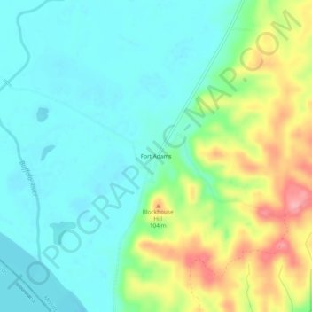
Name: Fort Adams topographic map, elevation, terrain.
Location: Fort Adams, Wilkinson County, Mississippi, United States (31.06656 -91.56817 31.10656 -91.52817)
Average elevation: 42 m
Minimum elevation: 8 m
Maximum elevation: 121 m
Thank you for supporting this site ❤️
Make a donation
Make a donation
Other topographic maps
Click on a map to view its topography, its elevation and its terrain.