
Thank you for supporting this site ❤️
Make a donation
Make a donation
Courcelles topographic map
Click on the map to display elevation.
Thank you for supporting this site ❤️
Make a donation
Make a donation
About this map
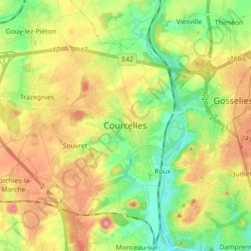
Name: Courcelles topographic map, elevation, terrain.
Location: Courcelles, Charleroi, Hainaut, Wallonie, 6180, Belgique (50.41747 4.33601 50.49747 4.41601)
Average elevation: 151 m
Minimum elevation: 101 m
Maximum elevation: 214 m
Thank you for supporting this site ❤️
Make a donation
Make a donation
Other topographic maps
Click on a map to view its topography, its elevation and its terrain.