
Thank you for supporting this site ❤️
Make a donation
Make a donation
Tronconal topographic map
Click on the map to display elevation.
Thank you for supporting this site ❤️
Make a donation
Make a donation
About this map
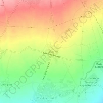
Name: Tronconal topographic map, elevation, terrain.
Location: Tronconal, Huaquechula, Puebla, 74375, México (18.78508 -98.50287 18.82508 -98.46287)
Average elevation: 1,674 m
Minimum elevation: 1,615 m
Maximum elevation: 1,732 m
Thank you for supporting this site ❤️
Make a donation
Make a donation
Other topographic maps
Click on a map to view its topography, its elevation and its terrain.