
Thank you for supporting this site ❤️
Make a donation
Make a donation
Hjelteryggen topographic map
Click on the map to display elevation.
Thank you for supporting this site ❤️
Make a donation
Make a donation
About this map
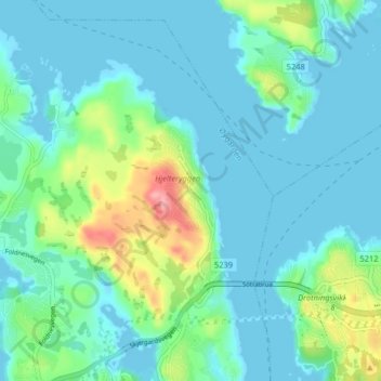
Name: Hjelteryggen topographic map, elevation, terrain.
Location: Hjelteryggen, Straume, Øygarden, Vestland, 5355, Norge (60.36240 5.13262 60.40240 5.17262)
Average elevation: 23 m
Minimum elevation: -6 m
Maximum elevation: 117 m
Thank you for supporting this site ❤️
Make a donation
Make a donation
Other topographic maps
Click on a map to view its topography, its elevation and its terrain.