
Thank you for supporting this site ❤️
Make a donation
Make a donation
La Fouly topographic map
Click on the map to display elevation.
Thank you for supporting this site ❤️
Make a donation
Make a donation
About this map
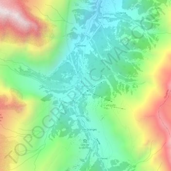
Name: La Fouly topographic map, elevation, terrain.
Location: La Fouly, Orsières, Entremont, Valais, 2303, Suisse (45.91312 7.07897 45.95312 7.11897)
Average elevation: 2,005 m
Minimum elevation: 1,456 m
Maximum elevation: 3,018 m
Thank you for supporting this site ❤️
Make a donation
Make a donation
Other topographic maps
Click on a map to view its topography, its elevation and its terrain.