
Thank you for supporting this site ❤️
Make a donation
Make a donation
Pisgah Mountain topographic map
Click on the map to display elevation.
Thank you for supporting this site ❤️
Make a donation
Make a donation
About this map
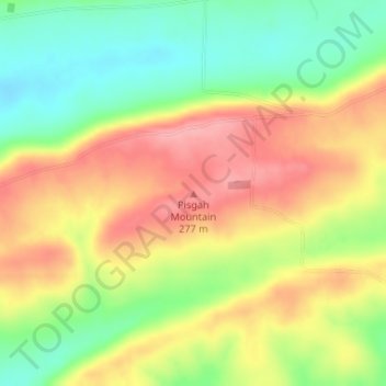
Name: Pisgah Mountain topographic map, elevation, terrain.
Location: Pisgah Mountain, Logan County, Arkansas, United States (35.20587 -93.85386 35.20597 -93.85376)
Average elevation: 234 m
Minimum elevation: 179 m
Maximum elevation: 287 m
Thank you for supporting this site ❤️
Make a donation
Make a donation
Other topographic maps
Click on a map to view its topography, its elevation and its terrain.