
Thank you for supporting this site ❤️
Make a donation
Make a donation
Axtla de Terrazas topographic map
Click on the map to display elevation.
Thank you for supporting this site ❤️
Make a donation
Make a donation
About this map
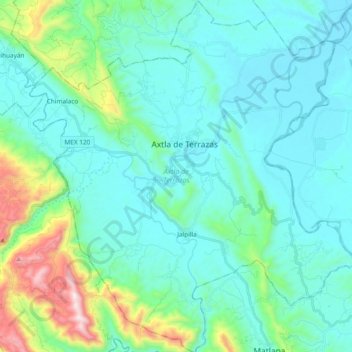
Name: Axtla de Terrazas topographic map, elevation, terrain.
Location: Axtla de Terrazas, San Luis Potosí, Mexico (21.33602 -98.95662 21.51147 -98.78032)
Average elevation: 212 m
Minimum elevation: 54 m
Maximum elevation: 969 m
Thank you for supporting this site ❤️
Make a donation
Make a donation
Other topographic maps
Click on a map to view its topography, its elevation and its terrain.
San Luis Potosí City
Mexico > San Luis Potosi > Municipio de San Luis Potosí
San Luis Potosí, commonly referred to as San Luis, or by its initials SLP (Otomi: Nmiñ'u), is the capital and the most populous city of the Mexican state of San Luis Potosí. It is the municipal seat of the surrounding municipality of San Luis Potosí. The city lies at an elevation of 1,864 metres (6,115…
Average elevation: 2,004 m