
Thank you for supporting this site ❤️
Make a donation
Make a donation
Walvis Bay topographic map
Click on the map to display elevation.
Thank you for supporting this site ❤️
Make a donation
Make a donation
About this map
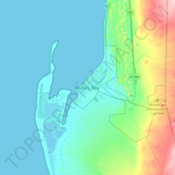
Name: Walvis Bay topographic map, elevation, terrain.
Location: Walvis Bay, Erongo Region, 13013, Namibia (-23.11576 14.34711 -22.79576 14.66711)
Average elevation: 30 m
Minimum elevation: -2 m
Maximum elevation: 172 m
Thank you for supporting this site ❤️
Make a donation
Make a donation