
Thank you for supporting this site ❤️
Make a donation
Make a donation
Corma topographic map
Click on the map to display elevation.
Thank you for supporting this site ❤️
Make a donation
Make a donation
About this map
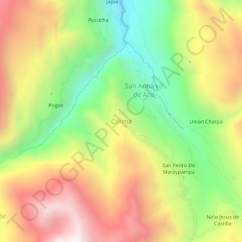
Name: Corma topographic map, elevation, terrain.
Location: Corma, Mirgas, Antonio Raymondi, Áncash, Perú (-9.13533 -77.13091 -9.09533 -77.09091)
Average elevation: 3,753 m
Minimum elevation: 3,179 m
Maximum elevation: 4,365 m
Thank you for supporting this site ❤️
Make a donation
Make a donation