
塔公乡 topographic map
Interactive map
Click on the map to display elevation.
About this map
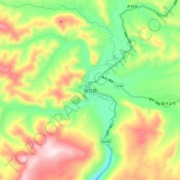
Name: 塔公乡 topographic map, elevation, terrain.
Location: 塔公乡, དར་མདོ་རྫོང་ 康定市, དཀར་མཛེས 甘孜藏族自治州, Sichuan, China (30.28022 101.48130 30.36022 101.56130)
Average elevation: 3,874 m
Minimum elevation: 3,626 m
Maximum elevation: 4,188 m