
Thank you for supporting this site ❤️
Make a donation
Make a donation
Red Bluff topographic map
Click on the map to display elevation.
Thank you for supporting this site ❤️
Make a donation
Make a donation
About this map
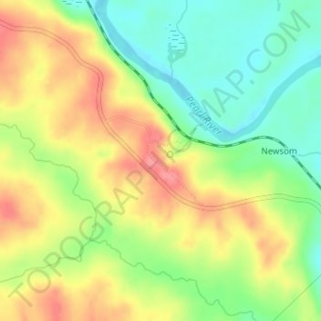
Name: Red Bluff topographic map, elevation, terrain.
Location: Red Bluff, Marion County, Mississippi, United States (31.32540 -89.94597 31.32550 -89.94587)
Average elevation: 76 m
Minimum elevation: 37 m
Maximum elevation: 117 m
Thank you for supporting this site ❤️
Make a donation
Make a donation
Other topographic maps
Click on a map to view its topography, its elevation and its terrain.