
Thank you for supporting this site ❤️
Make a donation
Make a donation
Lingayen topographic map
Click on the map to display elevation.
Thank you for supporting this site ❤️
Make a donation
Make a donation
About this map
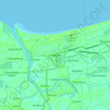
Name: Lingayen topographic map, elevation, terrain.
Location: Lingayen, Pangasinan, Ilocos Region, 2401, Philippines (15.98064 120.19071 16.06064 120.27071)
Average elevation: 4 m
Minimum elevation: -1 m
Maximum elevation: 15 m
Thank you for supporting this site ❤️
Make a donation
Make a donation
Other topographic maps
Click on a map to view its topography, its elevation and its terrain.