
Rutherglen topographic map
Interactive map
Click on the map to display elevation.
About this map
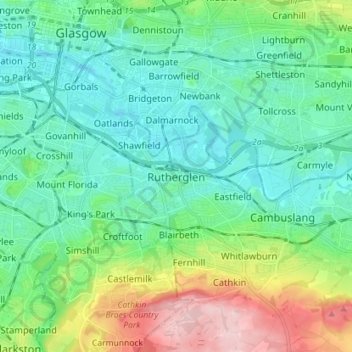
Name: Rutherglen topographic map, elevation, terrain.
Location: Rutherglen, South Lanarkshire, Escócia, G73 2HP, Reino Unido (55.78839 -4.25165 55.86839 -4.17165)
Average elevation: 55 m
Minimum elevation: 2 m
Maximum elevation: 211 m