
Lemnos topographic map
Interactive map
Click on the map to display elevation.
About this map
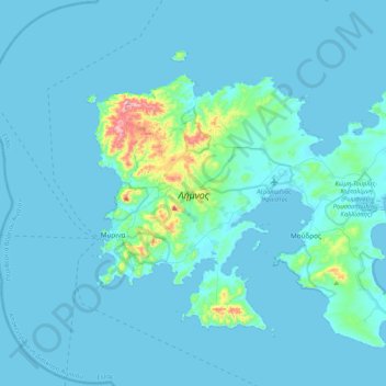
Name: Lemnos topographic map, elevation, terrain.
Location: Lemnos, Lemnos Regional Unit, Northern Aegean, Aegean, Greece (39.78170 25.03318 40.03604 25.44722)
Average elevation: 27 m
Minimum elevation: 0 m
Maximum elevation: 430 m