
Oosterend topographic map
Interactive map
Click on the map to display elevation.
About this map
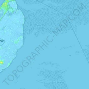
Name: Oosterend topographic map, elevation, terrain.
Location: Oosterend, Texel, Nordholland, Niederlande (53.01842 4.82907 53.14327 5.14428)
Average elevation: 0 m
Minimum elevation: -4 m
Maximum elevation: 13 m
Other topographic maps
Click on a map to view its topography, its elevation and its terrain.
De Koog
Niederlande > Nordholland > Texel
De Koog, Texel, Nordholland, Niederlande
Average elevation: 1 m
Den Burg
Niederlande > Nordholland > Texel
Den Burg, Texel, Nordholland, Niederlande
Average elevation: 1 m