
Tamarin River topographic map
Interactive map
Click on the map to display elevation.
About this map
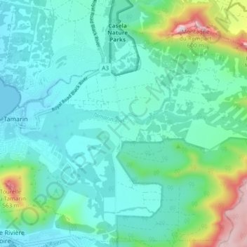
Name: Tamarin River topographic map, elevation, terrain.
Location: Tamarin River, Tamarin, Black River, Mauritius (-20.33528 57.37904 -20.32562 57.45236)
Average elevation: 122 m
Minimum elevation: 0 m
Maximum elevation: 618 m