
Thank you for supporting this site ❤️
Make a donation
Make a donation
LeRoy topographic map
Click on the map to display elevation.
Thank you for supporting this site ❤️
Make a donation
Make a donation
About this map
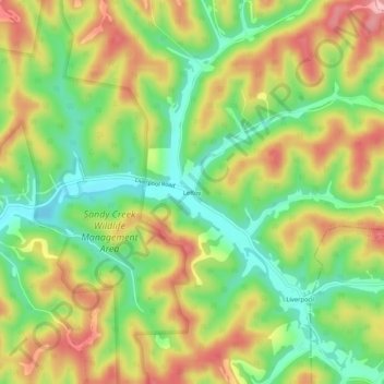
Name: LeRoy topographic map, elevation, terrain.
Location: LeRoy, Jackson County, West Virginia, 25252, United States (38.88592 -81.56512 38.92592 -81.52512)
Average elevation: 257 m
Minimum elevation: 185 m
Maximum elevation: 340 m
Thank you for supporting this site ❤️
Make a donation
Make a donation
Other topographic maps
Click on a map to view its topography, its elevation and its terrain.