
Thank you for supporting this site ❤️
Make a donation
Make a donation
Nabadwip topographic map
Click on the map to display elevation.
Thank you for supporting this site ❤️
Make a donation
Make a donation
About this map
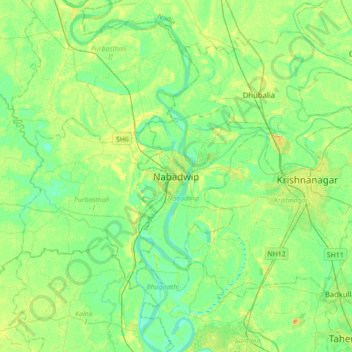
Name: Nabadwip topographic map, elevation, terrain.
Location: Nabadwip, Nadia, West Bengal, 741302, India (23.24867 88.20580 23.56867 88.52580)
Average elevation: 12 m
Minimum elevation: 2 m
Maximum elevation: 28 m
Thank you for supporting this site ❤️
Make a donation
Make a donation
Other topographic maps
Click on a map to view its topography, its elevation and its terrain.