
Thank you for supporting this site ❤️
Make a donation
Make a donation
Ocotito topographic map
Click on the map to display elevation.
Thank you for supporting this site ❤️
Make a donation
Make a donation
About this map
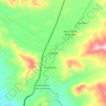
Name: Ocotito topographic map, elevation, terrain.
Location: Ocotito, Chilpancingo de los Bravo, Guerrero, México (17.20528 -99.55472 17.28528 -99.47472)
Average elevation: 771 m
Minimum elevation: 407 m
Maximum elevation: 1,423 m
Thank you for supporting this site ❤️
Make a donation
Make a donation