
Bramley topographic map
Interactive map
Click on the map to display elevation.
About this map
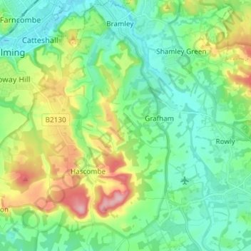
Name: Bramley topographic map, elevation, terrain.
Location: Bramley, Waverley, Surrey, South East, England, United Kingdom (51.12506 -0.58728 51.20168 -0.52470)
Average elevation: 81 m
Minimum elevation: 32 m
Maximum elevation: 200 m
Other topographic maps
Click on a map to view its topography, its elevation and its terrain.
Dockenfield
United Kingdom > England > Waverley
Dockenfield, Waverley, Surrey, South East, England, United Kingdom
Average elevation: 81 m
Busbridge
United Kingdom > England > Waverley
Busbridge, Waverley, Surrey, South East, England, United Kingdom
Average elevation: 91 m