
Thank you for supporting this site ❤️
Make a donation
Make a donation
Clark topographic map
Click on the map to display elevation.
Thank you for supporting this site ❤️
Make a donation
Make a donation
About this map
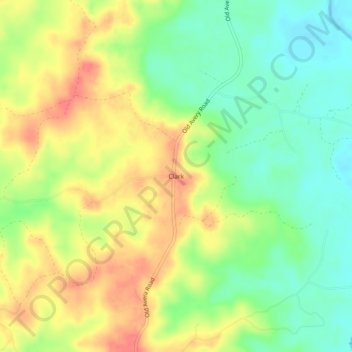
Name: Clark topographic map, elevation, terrain.
Location: Clark, Greene County, Mississippi, United States (31.26823 -88.59391 31.30823 -88.55391)
Average elevation: 52 m
Minimum elevation: 23 m
Maximum elevation: 83 m
Thank you for supporting this site ❤️
Make a donation
Make a donation
Other topographic maps
Click on a map to view its topography, its elevation and its terrain.